Table of Contents
Open Geodata Related to the Project
Web Mapping Services
Own Photos
Open Geodata Related to the Project
Web Mapping Services
*
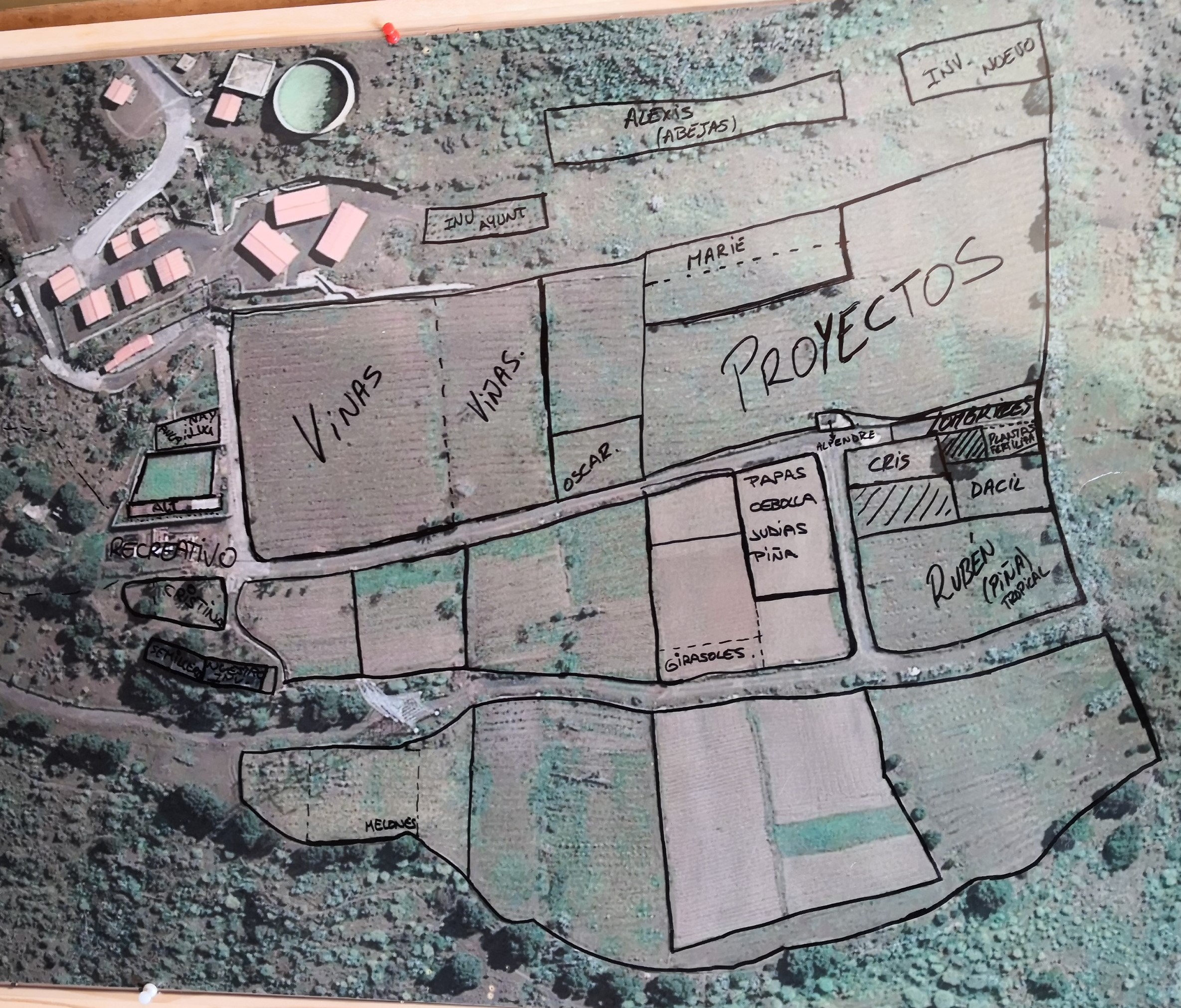
High resolution orthophotos
of the Canaries as Web Mapping Service (WMS)
Own Photos